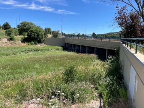
The Templeton Gap Levee Floodway is a 2-mile-long channel that carries runoff from east of Union Boulevard in the Pikeview neighborhood to Monument Creek. Levees on both sides of the channel help protect nearby homes and businesses from flooding.
The Federal Emergency Management Agency (FEMA) is producing new flood maps for El Paso County, and the levee needs upgrading to meet new requirements. A flood map is a detailed map that shows areas that are likely to flood during heavy rain, storms, or when rivers rise. It helps people understand how high water might get and how often flooding could happen in a specific place. Improving the levee will help reduce flood risk for people living along it. Because the levee was built before FEMA updated its standards in 2013, it no longer meets current guidelines.
The City of Colorado Springs Stormwater Enterprise is leading a project to design and build the needed improvements. Once work is finished, the levee will be recertified by FEMA.
Project Goals
If the levee is not certified, the area behind it would be placed in a flood zone called “Zone D,” which means the flood risk is unknown. If the levee is certified, the area is placed in “Shaded Zone X,” which means it is outside the main high‑risk flood zone (the 1% chance annual flood, sometimes called the 100‑year flood).
Even though the levee was originally built by the U.S. Army Corps of Engineers, the City of Colorado Springs is responsible for maintaining it and making sure it stays in good condition.
The City takes part in FEMA’s Community Rating System (CRS). Because of this, people who live in high‑risk flood areas get a 25% discount on their flood insurance, and people in other areas get a 10% discount.
There are other ways to lower your flood insurance cost. Some examples include:
- Grandfathering: keeping an older, lower rate after maps change.
- Higher deductible: choosing to pay more out of pocket if there is damage, which lowers your monthly cost.
- Mitigation: making improvements to your home to reduce flood damage.
Your insurance agent can help you understand which options are best for your budget. To learn more about flood insurance or to find an agent, visit FEMA’s website at FloodSmart.gov.
Project Background
The Federal Emergency Management Agency (FEMA) defines a levee as a “man-made structure, usually made of dirt and concrete, that is built to help control or redirect water during a flood.”
A levee breach happens when part of a levee breaks and lets water through. This can happen slowly or suddenly. The most dangerous breaches happen quickly when water levels are high. When this happens, water can rush into the area behind the levee with little or no warning.
People often hear the term “100‑year flood.” This does not mean a flood that happens once every 100 years. It means there is a 1% chance of a large flood of a certain size happening in any given year. These floods can happen more than once in the same year or in back‑to‑back years. The size of a “100‑year” flood can also change over time as scientists collect more data and as climate conditions change. Hydrologists, who study how water moves, use this information to estimate how often big storms or floods might happen.
Flood risk depends on two things:
- How likely it is that a large flood will occur, and
- How much damage or loss a flood could cause to people, homes and property
People at the highest risk usually live in flood‑prone areas and have property that would be costly or hard to replace.
To find out if you live in a flood zone visit FEMA’s online Flood Maps at msc.fema.gov/portal/search. Or use the FEMA National Flood Hazard Viewer at fema.gov/flood-maps/national-flood-hazard-layer.
Funding
This project is funded by the current Stormwater Fee.
Public Engagement
Come learn more about the Templeton Gap Levee Certification project and how flood risk impacts your property, insurance, and safety.
Public Open House #2
Date: Tuesday, April 28, 2026
Time: 5:00 p.m.-6:30 p.m.
Location: Colorado Springs Senior Center (1514 N. Hancock Avenue)
In accordance with the Americans with Disabilities Act of 1990 ("ADA"), and Title VI of the Civil Rights Act, the City of Colorado Springs will not discriminate against qualified individuals with disabilities, and those with Limited English Proficiency. Anyone requiring an auxiliary aid, language services, or reasonable accommodation to participate in this program should make the request as soon as possible but no later than 48 hours before the scheduled event to City.Engineering@ColoradoSprings.gov or call City Engineering at 719-385-5918. Dial 711 or 800-659-3656 for Relay Colorado.
Past Engagement
Public Open House #1
Date: Wednesday, April 8, 2026
Time: 5:00 p.m.-6:30 p.m.
Location: Colorado Springs Senior Center 1514 N. Hancock Avenue)