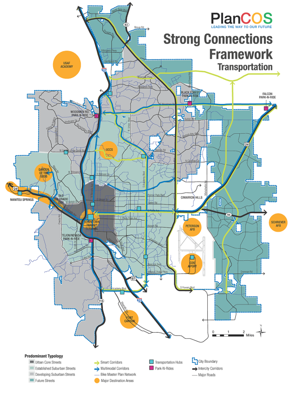
The Mobility Framework Map provides a high level graphic framework of the transportation vision for Strong Connections. This map is intended to be used as one means of furthering the City’s focus on enhancing the multimodal opportunities in the city and on improving the efficiency of the system. This map is expected to be a living and evolving graphic. It is recognized that some major streets combine the characteristics of more than one typology. As a high level city-wide framework, this map is also not able or intended to fully represent the sometimes unique and important conditions associated with specific segments of larger and sometimes multistreet corridors. This map is not intended to strictly define street types for all city streets. More detail will be provided with the City’s Intermodal Mobility Plan.

