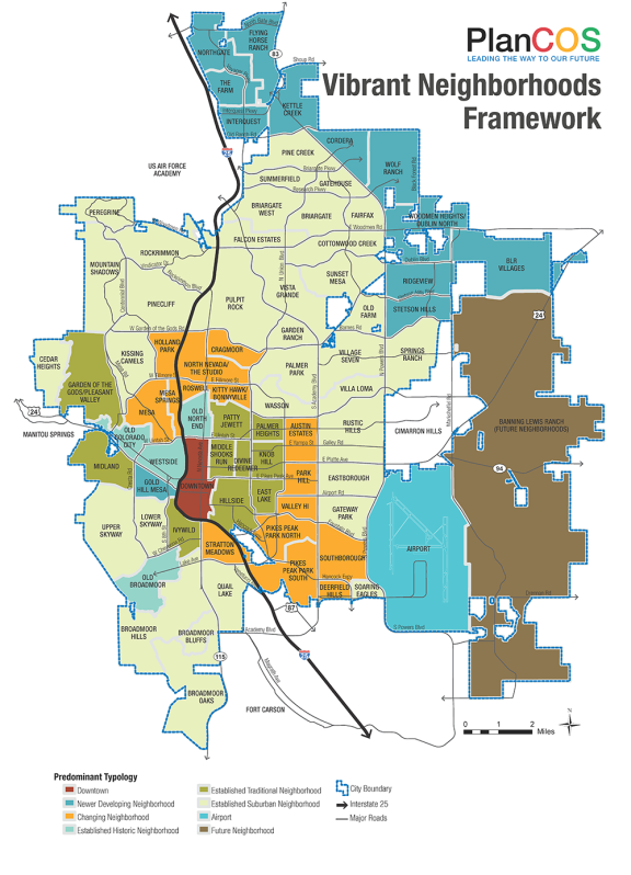
The Neighborhood Framework Map provides a graphic framework for our vision of Vibrant Neighborhoods. This map is intended to further the City’s focus on neighborhood planning based on logical, manageable, and inclusive areas. This map is expected to be a living and evolving graphic as neighborhoods grow or change. The City and neighborhoods can use this map to determine available resources and opportunities to leverage them.
All areas of the city have been identified by neighborhood name and typology for the purposes of generalizing a development pattern. This map is not intended to strictly define neighborhood boundaries or create neighborhood identity. In order to realize the full spectrum of neighborhood identification, representation, advocacy, and planning needs, more refined neighborhood boundaries based on neighborhood identity will be necessary. For purposes of broader identification and strategy, smaller neighborhoods may be combined into larger macro-neighborhoods (e.g. all of Briargate or all of the Westside).